
A group of scientists from around the world has undertaken an exciting mission to uncover the mysteries of Zealandia, often called the ‘eighth continent.’ They’ve created an impressive new map that tells us a lot about this hidden part of our planet.
Where in the World is Zealandia?
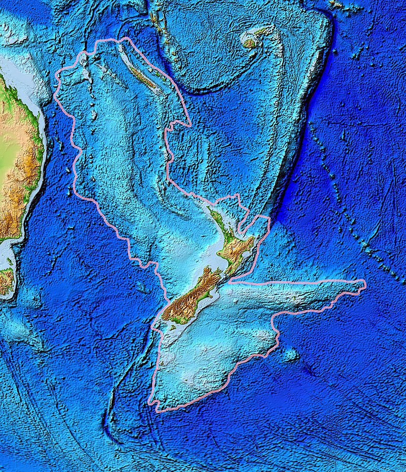
Zealandia might sound like something from a fantasy story, but it’s a real place hiding beneath the Pacific Ocean. In fact, a whopping 94% of it is underwater! The remaining 6% pokes out of the water, including places like New Zealand and nearby islands.
The Ancient Story of Zealandia
Zealandia’s history goes way back, around 83 million years ago. It all began when massive volcanic forces caused a supercontinent called Gondwana to break apart. This breakup eventually led to the continents we know today.
Creating the Detailed Map
Making this new map was a big job. The scientists used a bunch of methods to reveal Zealandia’s secrets. Here’s how they did it:
1. Examining Oceanic Rocks and Sediments: They carefully studied rocks and sediments taken from the ocean floor. These precious materials were collected during special underwater drilling and coastal trips.
2. Analyzing Seismic Data: The researchers also looked at data from earthquakes in the Zealandia area. This data helped them understand what the continent is made of.
3. Mapping the Whole Continent: With all this information in hand, the scientists got to work on the huge task of mapping Zealandia. Imagine mapping an area as big as 5 million square kilometers underwater!
Unlocking Geological Mysteries
Their hard work paid off. They found some interesting things about the geology of Western Antarctica, hinting at the possibility of a subduction zone near the Campbell Plateau on New Zealand’s western coast. This is where tectonic plates slide under each other. However, there are still magnetic patterns in the region that suggest a different type of movement along the Campbell Fault.
The scientists believe that these magnetic patterns happened when Gondwana was being stretched apart, like pulling apart a piece of bread. This stretching caused a big break, creating the ocean floor that’s now part of Zealandia.
In a nutshell, this new map and research help us understand more about Zealandia, a hidden world beneath the waves. It’s like uncovering the Earth’s secrets one discovery at a time!


